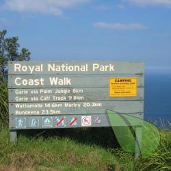
Werrong Beach
Otford, NSW 2508 Australia
Approximately 40 km south of Sydney near Stanwell Park is Werrong Beach, set in the Royal National Park. Gazetted in 1879, this was Australia's first National Park and only the second in the world.rWerrong Beach is a large amphitheatre about 300 metres long, surrounded by cliffs with a grassed...
About
Werrong Beach
Otford, NSW 2508 AustraliaAbout Werrong Beach
Approximately 40 km south of Sydney near Stanwell Park is Werrong Beach, set in the Royal National Park. Gazetted in 1879, this was Australia's first National Park and only the second in the world.rWerrong Beach is a large amphitheatre about 300 metres long, surrounded by cliffs with a grassed area behind the beach.rFor visitors without a car, it makes a great day trip and you may take the train from as far away as Sydney's Central Station. Take the South Coast Line. Your destination is Otford.
Werrong Beach Directions
From Sydney take the Princes Highway south to the F6 Freeway, and follow the signs toward Stanwell Park until you turn left to Otford Lookout. Go past the Royal National Park sign and park beyond the shop. From here walk up the good path to the Werrong Beach and Burning Palms Clifftop Walk. The path then descends steeply to Werrong Beach. The total distance around 1.5 km and steep in places, so it is not suitable for the elderly or the handicapped. ** If you are travelling by train, take the South Coast Line and disembark at Otford Station. It is an approximate 10 min walk to the beginning of the track described above. **
